To make fishing sustainable, we need to track fish as they move around the world
Wealthier nations have extensive telemetry networks, but the majority of worldwide fish catch goes untracked
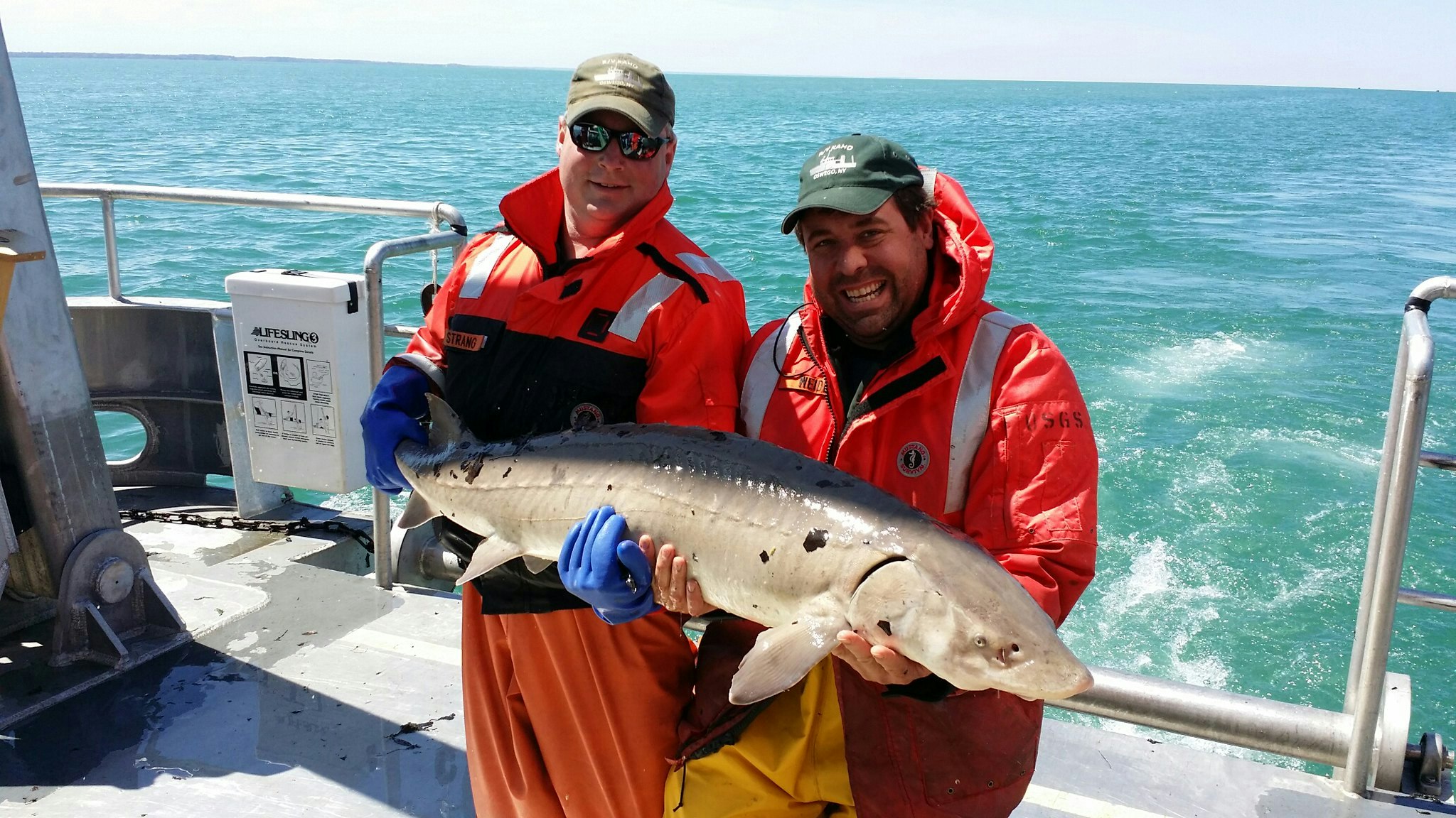
US Geological Survey via Flickr
Think about the last time you ate fish — do you know where that fish came from?
If it was a large open ocean species like a tuna, whether from the Atlantic or the Pacific, that fish swam many miles before getting caught and ending up on your plate. Even if a fish is well-managed in one area, if it swims to another country where it is caught to be eaten, efforts at management and conservation will have been in vain. We need to know where fish go so we can manage them sustainably. To know where they go, we need to track them.
The largest and most developed fish tracking research projects are in North America, though other large networks exist in Europe and Australia. Much of the coastline of Asia and Latin America, however, is without this type of research. Out of all the work that is being done, much of it is occurring in wealthy countries, but fish don't respect borders.
Scientists are banding together to collaborate and share fish tracking data. These collaborations come in the form of telemetry networks: national or regional groups that gain a deeper understanding about their local species by pooling data and equipment. Beyond that, "telemetry networks foster communities", says Joy Young, a researcher at the Florida Fish and Wildlife Conservation Commission and a member of the Florida Atlantic Coast Telemetry (FACT) network. "They bring together scientists to share successes and failures, seek advice, and make connections that seed collaborative research projects." These networks are the future of the field, giving scientists more resources to help them work, however, they are not evenly spread across the globe.
Global fish catch is about 90-95 million tons per year. East Asia and the Pacific account for 45% of that, followed by Europe and Central Asia (16% of global catch), then Latin America and the Caribbean (11% of global catch). In terms of income, 68% of the global catch comes from middle-income countries: the four biggest countries in this category are Brazil, Russia, India, and China.
The most popular methods of fish tracking involve using electronic tags attached to an animal, which produce a signal that can be heard by receiving equipment. There is satellite telemetry, which uses tags attached the outside of an animal that transmit their position to satellites. This method can track highly migratory species but can only get a location when an animal surfaces. The other option is acoustic telemetry, which uses implanted tags and can track an animal that stays underwater, but only works when the animal is within a few hundred meters of an acoustic receiver that a scientist has secured to the seafloor or dragged behind a boat.
The equipment needed to utilize acoustic or satellite telemetry in research is expensive. A single satellite tag costs over a thousand dollars. Acoustic tags are cheaper, costing only a few hundred dollars, but they require corresponding receivers, which can cost thousands of dollars and need to be deployed in arrays of multiple receivers. Two receivers placed at the mouth of a river can tell a scientist when a fish goes through the "gate" and which direction they are going, but arrays looking at fish home range size need to be large and close together, sometimes using hundreds of receivers.
.jpeg)
A US Fish and Wildlife Services scientist standing in a stream, tracking bull trout using radio telemetry
US Fish and Wildlife Services via Wikimedia
These barriers of cost and technological complexity are large ones for researchers in countries without the funding and scientific infrastructure of a large wealthy country like the United States. Fisheries managers in small coastal nations face other systemic difficulties as well, such as remote landing sites, seasonal and migrant workers, and weak bargaining power.
There are also political concerns at play. China is known for under-documenting, underreporting, or altogether altering records of the activities of its fishing fleet (ostensibly because of illegal activity), resulting in a low estimate of total fish catch. Much of the ocean (the "high seas") is out of jurisdiction of individual nations, and the difficult management tasks are left to regional groups. Sometimes fishers travel internationally to poach in the waters of other nations.
In spite of and because of the difficulties faced by low-income countries, high-income countries with experience in fish tracking should step in and support similar research in other countries around the world. Appropriately focused tracking studies can lead directly to management decisions. Encouragement for this work to get off the ground will give management entities the information they need to create global sustainable fisheries.
It is important for this support to be a collaboration, and to avoid "parachute science," where scientists from typically higher-income countries conduct field research in another typically lower-income country without engaging the community in the destination country. This practice creates a local dependency on external support, and can actually harm local efforts to perform research. When international scientists collaborate with local scientists and even untrained enthusiasts, there can be amazing outcomes.
First and foremost, funders can create some startup grants for foundational infrastructure in new areas, allowing scientists to purchase tags, receivers, and other equipment needed to deploy the research setup. This in itself should be a collaborative effort — international granting agencies, local government funding bodies, and other public and private stakeholders should provide some degree of matching funds.
The regional network Migramar, based in Mexico and the US, is a great example of an internationally supported network. Their website lists 24 allied organizations and 11 sponsors, each from multiple countries. Such support is crucial when tracking thousands of individual migratory animals moving internationally along the Eastern Pacific.
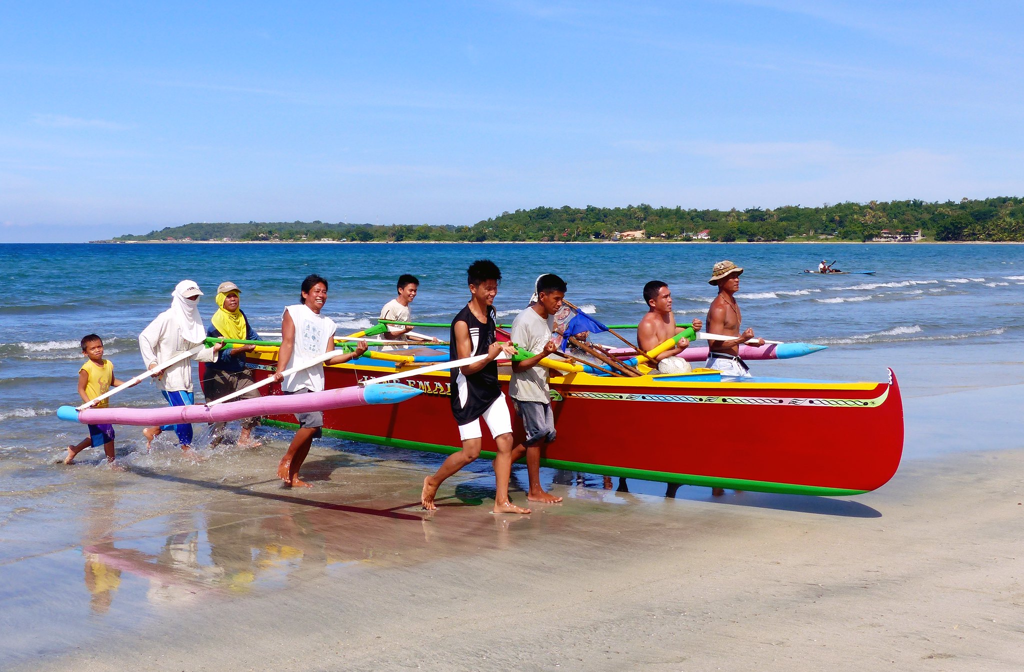
Fishers in Currimao Beach, Ilocos Norte, Philippines, hauling their boat ashore
Bernard Spragg via Flickr
The next step is to target potential areas for expanding research — existing labs in countries with high fish catch that have not yet explored telemetry, of which there are many in Asia and Latin America. For the most efficient use of conservation resources, target the areas with a high overlap of fishing effort and fish habitat. More and more countries are publishing fishing vessel tracking to identify illegal fishing, an important step to international conservation of large migratory species, from which the data can be used to find where fish tracking is needed. Local stakeholders, especially fishers, should be heavily involved or even drive the framing of a research agenda. When involved from the beginning, fishers can contribute local ecological knowledge to help form the study and be a part of the management decisions in such a way that they will be satisfied with the result.
Finally, funders should provide incentives for existing telemetry networks to create and share accessible resources detailing project design, equipment maintenance, data management, data analysis, and communication with management entities. Global telemetry networks can facilitate centralized data storage and quality control for large-scale studies, while encouraging smaller-scale regional studies to own their data and create publications. "A successful global strategy will leverage the existing regional networks, fill organizational gaps where needed, and champion causes to advance the science of movement and its application to conservation and management," said Young.
A great example of a global network doing just that is the Ocean Tracking Network, which connects smaller regional networks like FACT and creates a larger community for support and standardized data sharing systems. The more research is done, the more collaborations and partnerships are formed, and the more the field advances as a whole.
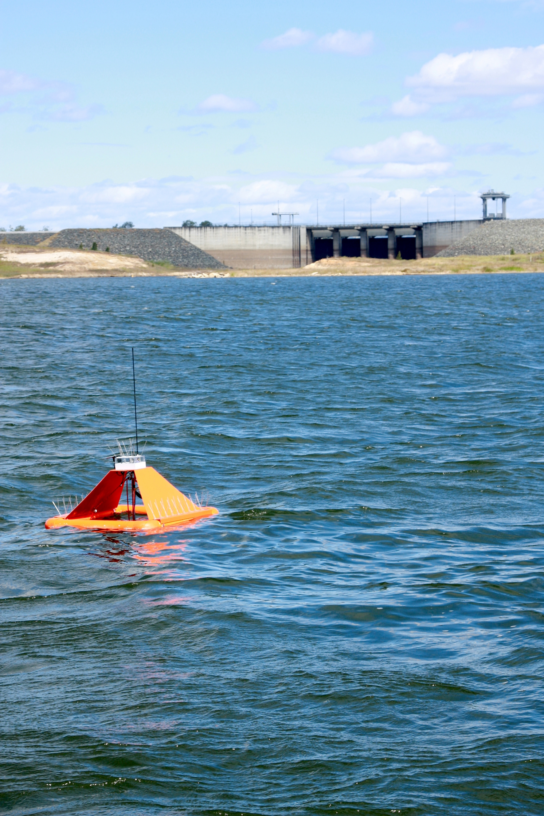
In a bay in Queensland, Australia, a floating remote sensor tracks environmental conditions
CSIRO via Wikimedia
This approach can be used for freshwater fisheries as well, which have increased their share of global seafood production from 16% in 1990 to 34% in 2013, and total catch hit a global record of 12 million tons in 2018. An example of a large freshwater telemetry network is the Great Lakes Acoustic Telemetry Observing System (GLATOS). This network tracks many species of fish all throughout the Great Lakes, a popular sportfishing region, and work closely with the fishing industry and fisheries managers to help with decision-making.
Fish tracking technology has only been used in the last 50 years or so, and it is becoming more sophisticated every year. Advances in battery duration and data storage have helped researchers to collect more data without changing methods. More recent advances have allowed researchers to know when a study animal has been eaten, when parts of the tag are dissolved by a predator's stomach acid. Ongoing advances in bio-logging— collecting biological parameters in conjunction with positional information— have led to the next 10 years being dubbed the "bio-logging decade". The technology is becoming smaller and cheaper, making it easier to promote widespread use.
The infrastructure for acoustic telemetry can even help advance other fields of science. Acoustic receiver mooring bases have been used as study substrate for scientists looking for sponge samples. Countries are conceiving of innovative applications such as warning beachgoers of nearby sharks in South Africa. Partnerships like this maximize cost benefits of deployment and promote multidisciplinary studies.
The only way to recover damaged fish populations is to stop fishing them the way we currently are. To learn what changes to make, telemetry networks are a key component. "The collective knowledge gathered as a result of telemetry networks increases our ability to effectively manage aquatic resources by fully understanding how animals interact with their environment", Young says. This means management strategies that protect fish when and where they are most vulnerable, which is where they are caught, not where they are eaten.
Cooperation and management should be on the same scale on which the fish operate, which for many species is global. This strategy will allow us to fill in management gaps to ensure a better, sustainable future, both for the fish and those who eat them.